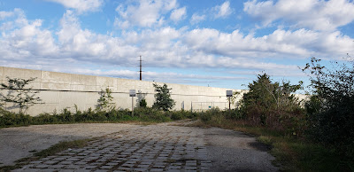
The old alignment of US 9 between Port Republic/Chestnut Neck and Bass River. The road is officially designated as 2.76 miles long, but most of the road has been abandoned and the bridge across the Mullica River has been removed. Less than a mile is open. The route was unsigned, until NJDOT added mileposts to the southern segment of NJ 167. The southern segment is the more fun of the two, while the northern segment is a tiny stub.
Southern segment:
Chestnut Neck has been around since Revolutionary times, and was a site of a battle. Part of NJ 167 could have been on a road that has existed since Revolutionary times. Look at the northernmost segment of King's Road/Ferry Road, as well as Fort Road on the old map.
Northern segment:
Only 800 feet of road exist between US 9 and the gate at the end of northern NJ 167.
The concrete used to continue straight and along another section of Old New York Road to reach CR 542, then picks up on US 9.


No comments:
Post a Comment