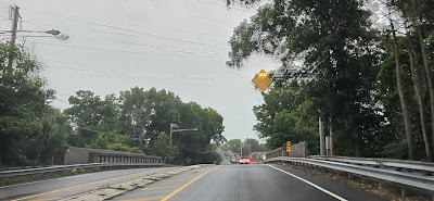
NJ 64 is a state-maintained bridge over the Northeast Corridor that was constructed in 1939. It carries CR 571 and CR 526*. That's it. However, this route was planned for much more. It was originally designated as NJSHR 31A, a spur from present-day US 206 (former NJSHR 31) from Princeton to present-day NJ 33 Hightstown. Much of that route would never be built (unless you count CR 571 as the realization of this). Additionally, NJ 64 was supposed to tie into NJ 133, one of the planned alignments for NJ 92. That connection between NJ 133 and NJ 64 was also never built. So now we're left with this. And NJ 64 is unsigned, with the exception of this one sign blade at its southern terminus.
The southern terminus of NJ 64 at Mercer CR 615 and CR 571 / CR 526*.
If you want proof this bridge is a state highway, look at the curb and guiderails. These are up to 1939 state highway standards. The state hasn't relinquished NJ 64 yet.
The northern terminus of NJ 64. CR 571 and CR 526* continue heading to Princeton.

MERCER County. There. I said it. And take note of CR 571 being signed north-south, which is what NJDOT officially recognizes CR 571 as. CR 571 is usually signed east-west.

UPDATE: The northern end of NJ 64 was reconstructed as a roundabout. The new sign reaffirms CR 571 as north-south and eliminates CR 526 signage. If this sign was mounted by Mercer County or NJDOT, why is the shield so ugly?
*CR 526 does not exist de jure from Princeton to the Mill Road (de jure CR 526) junction. It's legally only CR 571.


No comments:
Post a Comment